
Working Experience
MADAR provides advanced geospatial and drone-based services, including aerial mapping, LiDAR, thermal imaging, and environmental monitoring. We are committed to delivering accurate and efficient solutions that support urban planning, agriculture, infrastructure, and natural resource management across Jordan and the region. We are also preparing to expand into smart city solutions to support the future of connected and sustainable urban development.
Utilizing high-precision drones and sensors, we deliver detailed topographic, thermal, and multispectral data to empower informed decision-making for our clients.
With a skilled team and proven track record, MADAR offers dependable service, accurate reporting, and long-term support tailored to each project's unique needs.
Define project goals, flight routes, and camera settings using advanced software to ensure complete and efficient area coverage.
Conduct aerial data acquisition using high-resolution cameras, LiDAR, or multispectral sensors based on project needs.
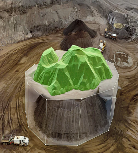
Transform raw data into accurate maps, 3D models, or GIS layers using photogrammetry and processing tools—ready for decision-making.
Deliver comprehensive reports, visualizations, and spatial insights tailored to your project’s goals—ready for strategic decisions.